Teleconnections: A Spatiotemporal Atlas of the Technosphere
How did a state shift in planetary conditions occur in the wake of local transformations and how does that state shift feed back to such localities, further spurring their transformations? Can we map, and thereby discern, the systemic drivers and their mutual interdependencies that mesh the global fabric of the Anthropocene? In the collaborative project Teleconnections we seek to develop a new visual grammar representing social, technological, and ecological transformations across space and time, helping to get an evolving technosphere into view.
Teleconnection in atmospheric science refers to climate anomalies being related to each other at large distances. Varied historical anomalies taking place at different locations around the globe and at different points in time eventually lead to the formation and further consolidation of today’s technosphere. With this project we want to show the interdependent pathways of their interacting with each other.
Conducive to the Great Acceleration Observatory and similar activities at the MPIGEA, the goal of the project is to create a map- and timeline-based environment by which different regional yet globally impactful histories of Anthropocene drivers—such as land use transformations, fossil and renewable energy infrastructures, water utilization, nuclear sites, plantation economies—can be compared, their global interconnections traced, and their structural agencies be highlighted. By investigating network nodes of the technosphere the project identifies, describes and analyzes local and long-distance effects of historical waves of technosphere consolidation. Distinct places and historical situations, material flows, natural or anthropogenic disasters, infrastructures and process architectures are used to identify and demonstrate mechanisms of action and localizable tipping points that unleashed potent dynamics of sociotechnical transformations. We speak of such compositions of interrelated Anthropocene nodes as “topologies of the technosphere.”

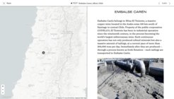
The technosphere is examined from the perspective of individual network nodes. These nodes are characterized by very specific interplays of different forms of causality, representing the interlaced complexities of Anthropocene drivers. Geography, political environment, historical situation, material and symbolic networks present at a specific location essentially define which technospheric mechanisms of action can take their starting point here. Times and locations such as the city of Baku in 1902/1992/2024, Port Radium in Canada in 1942, the Chilean Carén tailing reservoir as prospected in 2064, factory farming in Kansas in 1931/1952/1982/2024, the chemical industries at Leuna in 1916/1944/1999, the oil and gas industry in Galicia in 1890/1947, the city of Baton Rouge in 1940/1969, Lumumba in 1990, Enewetak Atoll in the Pacific Ocean in 1952, the hydro-electric dam at Aswan in 1970, or the Dnipro dam at Zaporizhia in 1932/2024 cannot be interpreted as individual cases without their multi-layered specifics; nor is it possible to understand the interactions of different spheres of influence and their interplay at the level of the technosphere without recourse to such network nodes.

The new science of geoanthropology is characterized by the explicit combination of earth-systemic and cultural-historical factors. So far, the Earth system sciences are largely unfamiliar with the technical-cultural as well as historical-social drivers that factor into the systems they study. Similarly, for the study of culture the inclusion of Earth system factors represents a so far largely neglected and misunderstood influence of fundamental parts of what culture and its transformations derive from. In the interplay of academic perspectives, the “historical sciences” stand here, in comparison with the "natural sciences", less for the introduction of “soft” and thus less powerful factors, but rather for an independent, and hardly less “hard” collection of facts. The presence of cultural artifacts and narratives, symbolic and visual phenomena are not dispensable additions in a causal analysis to a reality that can also be completely described in other ways, but conversely a causal factors central to the geoanthropological study of the transformation of collective behaviour and decisions and, the more generally, the genesis of the Anthropocene predicament. Places, scenarios, geographies, processes, infrastructures, and people are to be grasped in the perspective of geoanthroplogy as bundled expressions of causal factors that could not be addressed or detected elsewhere.
By way of creating a digital and dynamic topology of the technosphere this insight shall be made fruitful for the overall framework of the research to be established at MPIGEA. As a historical-geographical, but also as a curatorial-creative approach, the project utilizes the effectiveness of spatiotemporal mapping and thus a particularly accessible form of presenting the complex composition and the varied forms of interaction within the technosphere.
The vast archive of the Anthropocene Curriculum (AC) platform, as well as existing mapping projects serve as sources for some of the project’s primary contents. Various spatially and temporally distributed contents of the AC platform will therefore be collated and further enriched by historical contexts and external materials. Moreover, other researchers, both internal and external to MPIGEA, are invited to produce their own contribution, or collaborate with one of the editors/authors. Especially for members of the Anthropocene Commons network, the clear methodological approach of this project can serve as a format to extend the longstanding collaboration fruitfully and to develop existing projects in the network further in a distinguished geoanthropological way.


